Emissions
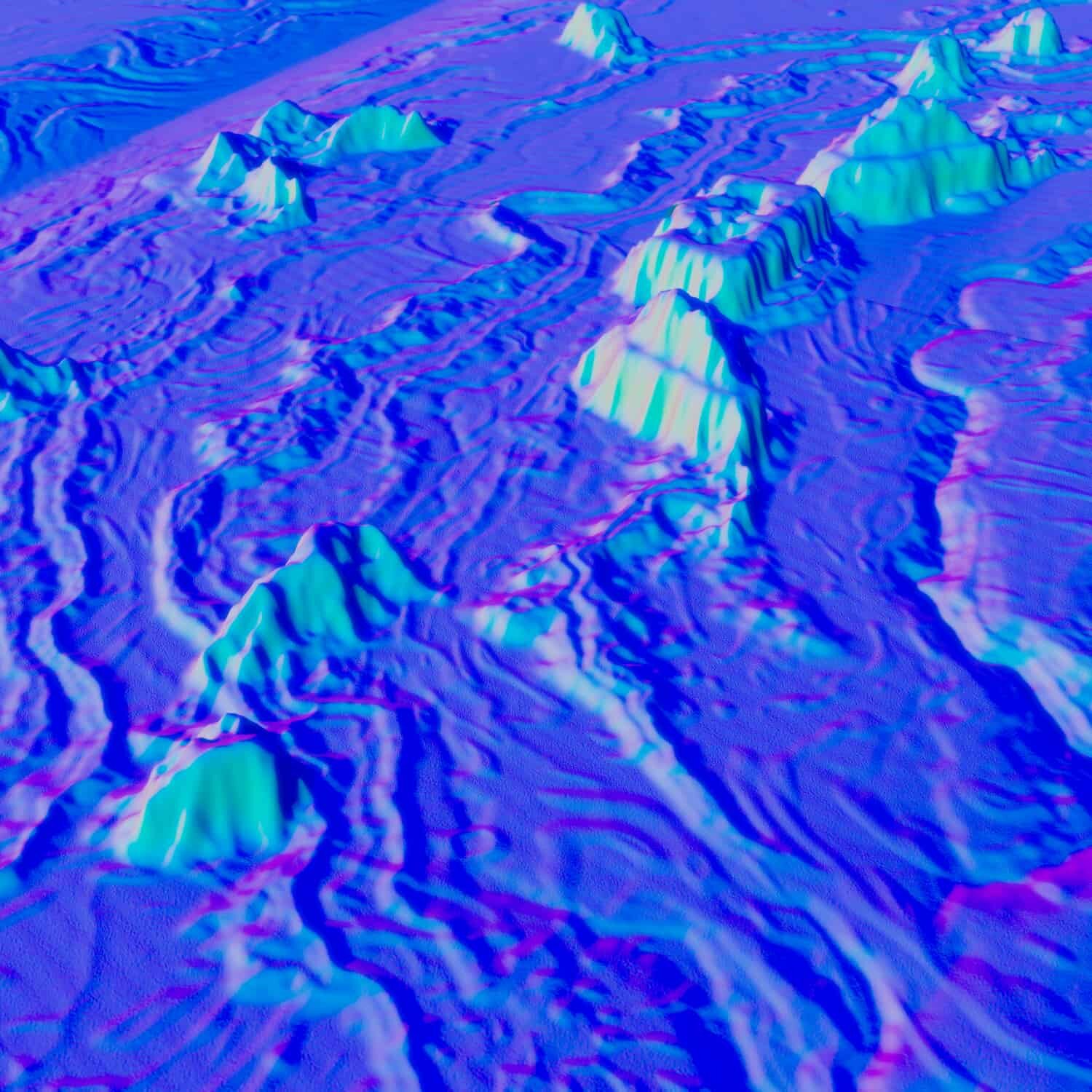
How familiar are you with the shape of the continents? What about the shape of the seafloor?
If you’re unfamiliar with the contours of our planet’s underwater mountain ranges and plateaus and valleys, then you’re not alone. No one really knows what’s down there; at least, not in any great detail. That’s because, well, the water is in the way, and that makes it hard for our mapping satellites to see down there. Even the seafloor maps we now have, the ones that include prominent underwater features, are often based on predictions from satellite observations of the oceans’ surface instead of observed data. At present, as much as 80% of the seafloor has yet to be mapped in detail. Even the Moon and Mars are mapped at a higher resolution than our own oceans.
Dr. Vicki Ferrini wants to change that. She is a marine geologist who specializes in bathymetry, the science of mapping underwater topography, and uses sonar to take measurements of water depth. She uses these measurements and other data to create topographic maps of the seafloor. Vicki is part of a global effort called Seabed 2030, an initiative sponsored by the Nippon Foundation and the General Bathymetric Chart of the Oceans (GEBCO) to create a high-resolution map of the entire ocean by the year 2030. Having a completed map will inform almost everything we do in the ocean, including modelling currents and the climate, exploring for minerals, oil, and gas, and managing fisheries and underwater habitats. Seafloor mapping was essential to the plate tectonics revolution, and some scientists think that a more detailed map could lead to another major shift in oceanography.
Vicki isn’t just interested in mapping the deep ocean. In this episode, Vicki tests a small sonar designed for shallow waters. She and her colleagues need it to map a shallow lake in the middle of a crater on a newly-formed island near Tonga in the South Pacific. Mapping this small lake will give Vicki and her colleagues some insight into how the island formed, and why it hasn’t eroded as quickly as other volcanic islands like it.
Producer James Dinneen went to Vicki’s childhood home on Cape Cod in Massachusetts to record as she tested the sonar device she was about to send off to her colleagues in Tonga.
This episode includes archival tape, used with permission from San Francisco Maritime National Park Association.
Producer: James Dinneen
Editor: Bethany Denton, Jeff Emtman
Music: James Dinneen, Lucky Dragons, The Black Spot